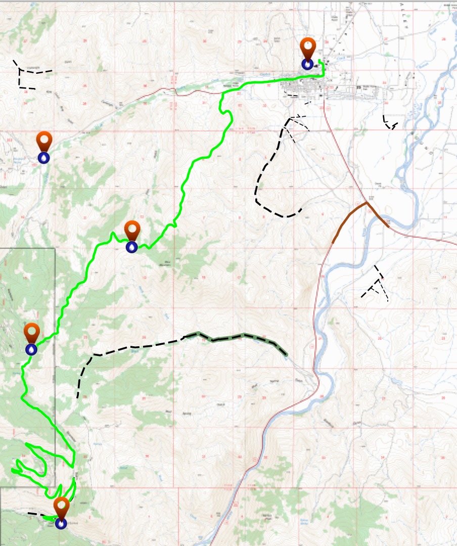
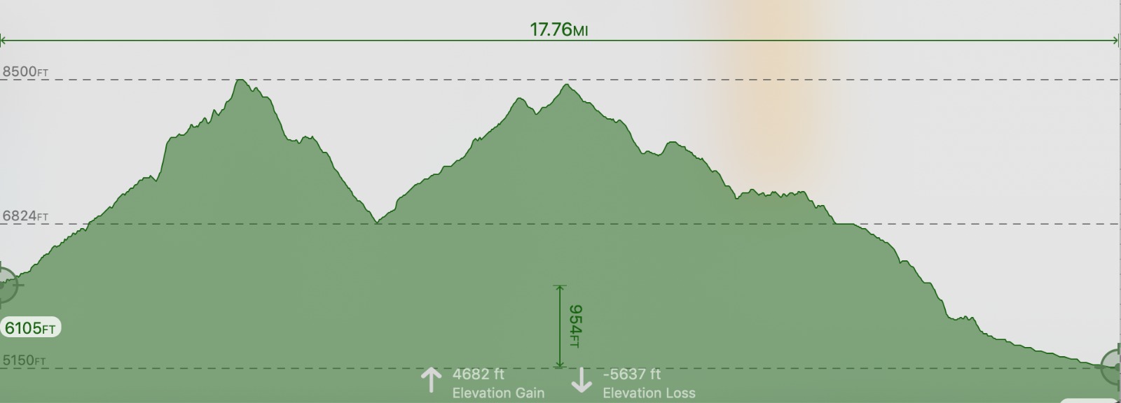
The 32K has about 4700′ elevation gain and 2 aid stations. The race is point to point from the Bayhorse ghost town to Challis.
Buses will provide transport for runners to the start.
32K Overview Map
To view the gpx file, click on the red link and look in the left margin for your race.
32K Map File
32K Elevation Profile
32K Aid Stations:
Click on RED link:
RONR AID STATION CHARTS 2026
 32K Course Description

START at BAYHORSE TOWNSITE – KEYSTONE (mile 9)
From the Idaho State Park at BAYHORSE, you will head up Road 052 for about a mile and take a left turn (west) on the Pacific Mine 4-wheeler road/trail. You will wind up and around the Pacific Mine ridge before dropping back down into the next drainage. Here the 108K splits and goes left, on the journey up Ramshorn. But you will turn right and drop back down to Road 052. Then left on Road 052, to Keystone Aid Station.
KEYSTONE – BIRCH CREEK SADDLE (MILE 12.5)
Leaving KEYSTONE, you will head on the Lombard Trail to Birch Creek Saddle.
BIRCH CREEK SADDLE – FINISH (mile 19.5)
After reaching BIRCH CREEK SADDLE, runners will run for 2 miles on the Lombard Trail past the saddle with the informational placard and drop down to the next saddle before taking off on a side trail to the left (north) away from the Lombard Trail, following elk trails along the sage ridge, down through the Challis Golf Course entering the road leading you down to Main Street Challis and to the finish at Challis City Park.