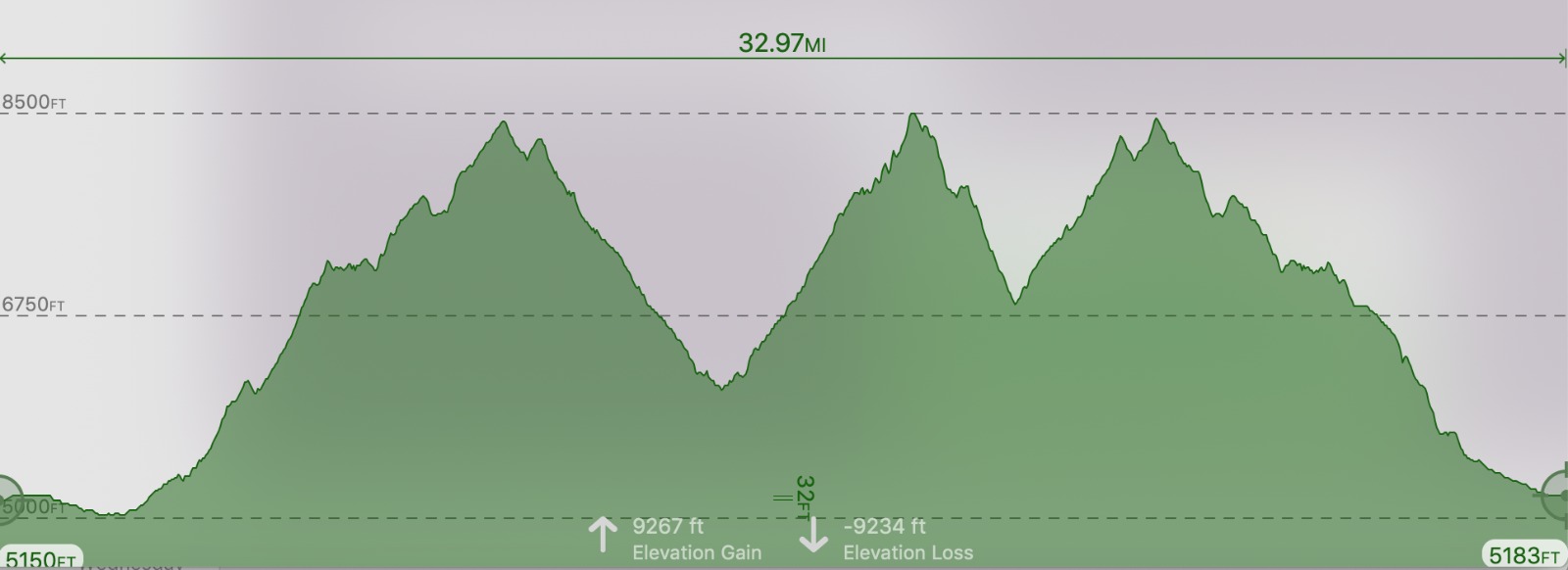
The 55K has about 9300′ elevation gain and 5 aid stations. It has two major climbs that take runners over 8000′ and is mostly narrow ATV trail, some dirt road and some pavement that will bring runners to the finish in Challis.
The start is 6:30 am. Cutoffs for the 55K are 5.5 hours to Bayhorse (12:00 pm), Keystone #2 (3:00 pm) and a 12:30 hour cutoff at the Finish. (7:00 pm)
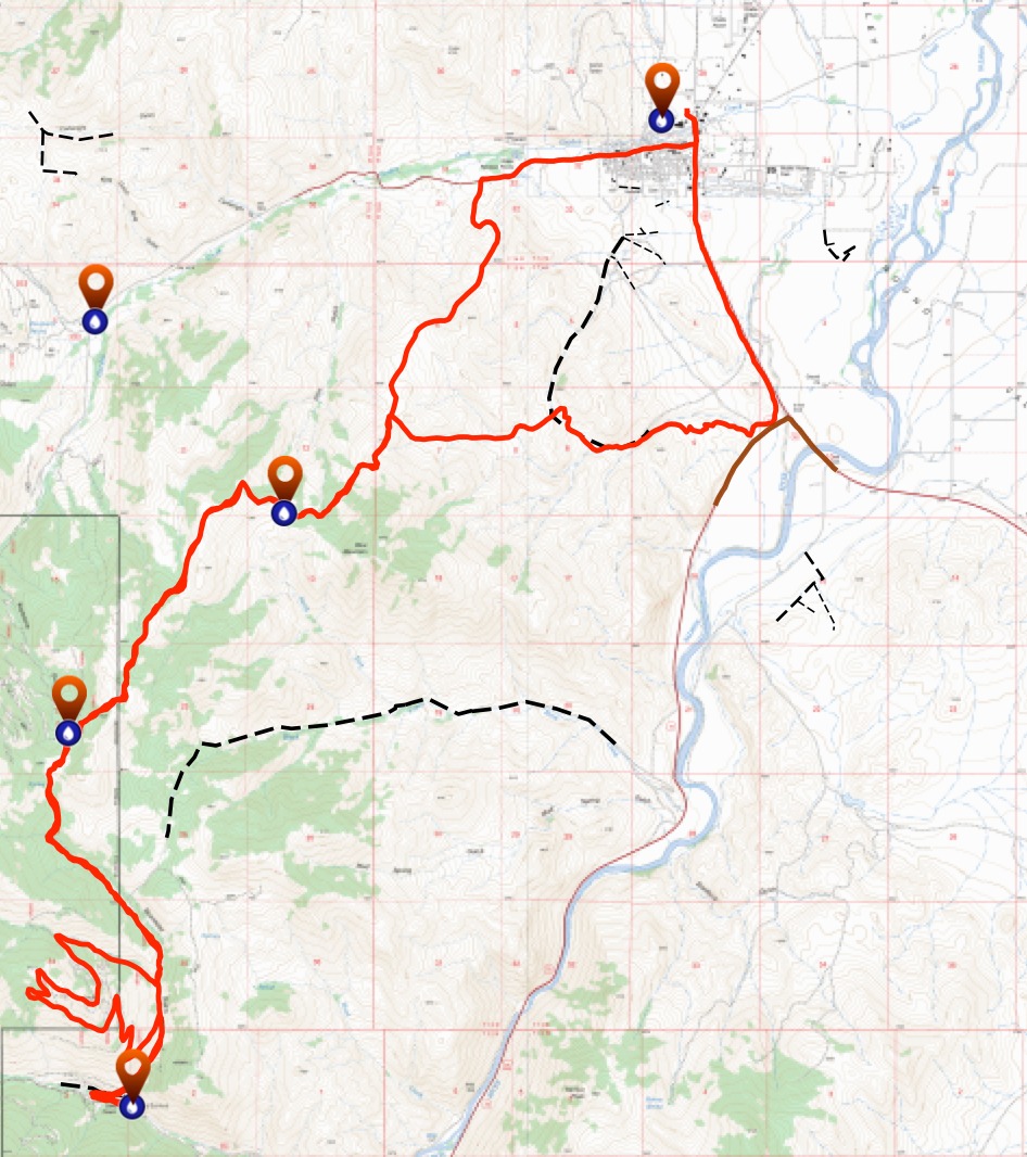
55K Overview Map
To view the gpx file, click on the red link and look in the left margin for your race.
55K Map File
55K Elevation Profile
55K Aid Stations
Click on RED link:
RONR AID STATION CHARTS 2026

55K Topo Maps
55K Course Description
START – BIRCH CREEK SADDLE (mile 9)
After leaving the START at the Challis City Park, you will head south on the HWY 93 shoulder for several hundred yards until reaching the 4-wheeler trail next to the highway on the right. Follow the two track trail to the Dump Road and jump on the trails winding through the sagebrush and over to the Lombard trail system, a two track trail that will lead you for quite some time. Stay on the Lombard Trail for a 4 mile climb, and up to a lower saddle where an informational placard will give you some geographic history of the surrounding area. Continue ~1.5 miles on the Lombard Trail (now cutting along Blue Mountain, side-hill) to the first Aid Station, BIRCH CREEK SADDLE.
BIRCH CREEK SADDLE – KEYSTONE (mile 12)
From BIRCH CREEK SADDLE, you’ll continue on the Lombard Trail and head up a tough climb before reaching another placard which describes the Bighorn Sheep in the area and their habitat. You wanted some views? Well here they are: The Salmon River below you, the Twin Peaks and the River of No Return Wilderness off to your right, Mt. Borah (Idaho’s tallest peak at 12,662’) off to the south skyline, and some wild, wild country ahead of you in the Salmon-Challis National Forest. The Lombard Trail climbs up to 8300’ now before descending sharply to an intersection where the aid station known as KEYSTONE will greet you. If you haven’t seen a deer, elk, antelope, sheep, bear, wolf, hawk or eagle by now then you hopefully registered under the Legally Blind category for the race.
KEYSTONE – BAYHORSE TOWNSITE (mile 16)
From the intersection at KEYSTONE, pick up Road 052 (go left-south) and ascend briefly to a summit before a 3.5 mile downhill cruise to the mining Ghost Town, BAYHORSE. You’ll pass by the abandoned mines, outbuildings and rail car transport structures on your adventure to BAYHORSE. Watch for a fabled old miner in these parts, named Choppy. If you think you see him, run faster. As you approach BAYHORSE past the old hillside mill, your crew can watch for you on the hillside coming down to the aid station.
BAYHORSE TOWNSITE – KEYSTONE (mile 25)
From the Idaho State Park at BAYHORSE, you will back track up Road 052 for about a mile and take a left turn (west) on the Pacific Mine 4-wheeler road/trail. You will wind up around the Pacific Mine ridge before dropping back down into the next drainage. Here the 108K splits and goes left, on the journey up Ramshorn. You will turn right and drop back down to Road 052. Then left on Road 052, returning to Keystone Aid Station.
KEYSTONE – BIRCH CREEK SADDLE (MILE 28)
Leaving KEYSTONE, you will retrace back on the Lombard Trail to Birch Creek Saddle.
BIRCH CREEK SADDLE – FINISH (mile 34)
After reaching BIRCH CREEK SADDLE, runners will run for 2 miles on the Lombard Trail past the saddle with the informational placard and down to the next saddle before taking off on a side trail to the left (north) away from the Lombard Trail, follow elk trails heading along the sage ridge, down through the Challis Golf Course and entering the road leading you down Main Street Challis and to the finish at Challis City Park.